
Map of France
Map of France > France Locator Map • France Travel Tips • France Relief Map
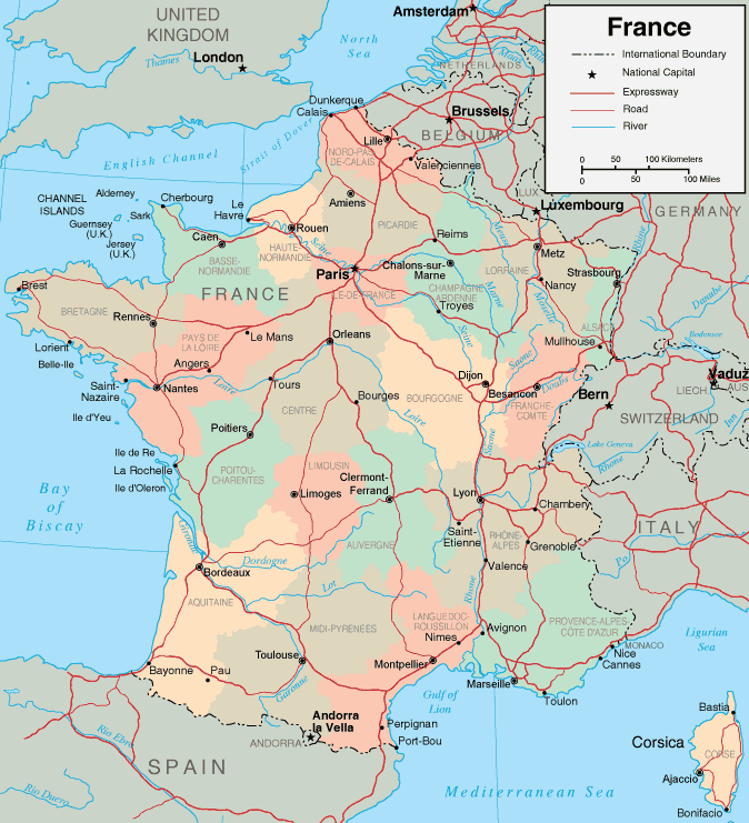
France Map, Showing Major Cities and Regions
Geography of France
 One of France's claims to fame is that it is the largest country in
Western Europe, and of all the European countries it boasts some of the
most varied scenery. While the northeast has the Vosge Mountains
overlooking the Rhine Valley, the southeast is home to the Jura Mountains
and the Alps, which separate France from Switzerland. On the other
side, the Pyrenees separate France from Spain. The Massif Central
between the Rhone-Saone Valley and the basin of Aquitaine is France's
only large highland area. This area actually covers one-sixth of
the entire country, and boasts dramatic peaks in excess of 5,900
feet. France's scenic hills region comprises Brittany and Normandy,
while northern France is made up of lowlands, including the Paris
Basin. The Aquitaine Basin is a lowlands area in the southwest,
while the Rhone-Saone Valley and the Mediterranean lowlands are located
in the southeast.
One of France's claims to fame is that it is the largest country in
Western Europe, and of all the European countries it boasts some of the
most varied scenery. While the northeast has the Vosge Mountains
overlooking the Rhine Valley, the southeast is home to the Jura Mountains
and the Alps, which separate France from Switzerland. On the other
side, the Pyrenees separate France from Spain. The Massif Central
between the Rhone-Saone Valley and the basin of Aquitaine is France's
only large highland area. This area actually covers one-sixth of
the entire country, and boasts dramatic peaks in excess of 5,900
feet. France's scenic hills region comprises Brittany and Normandy,
while northern France is made up of lowlands, including the Paris
Basin. The Aquitaine Basin is a lowlands area in the southwest,
while the Rhone-Saone Valley and the Mediterranean lowlands are located
in the southeast.
France's Climate
 France has a rather variable climate. Mild weather is prevalent in
the west, due to the Atlantic Ocean's moderating influences. In the
east, winters are generally colder and summers warmer. In general,
the climate becomes more temperate as one travels from north to
south. The Mediterranean Sea Coast enjoys dry, hot summers and
moist, mild winters, while the Alps, Jura, and Pyrenees Mountains are
known for their snowy winters which make them great locations for winter
sports activities.
France has a rather variable climate. Mild weather is prevalent in
the west, due to the Atlantic Ocean's moderating influences. In the
east, winters are generally colder and summers warmer. In general,
the climate becomes more temperate as one travels from north to
south. The Mediterranean Sea Coast enjoys dry, hot summers and
moist, mild winters, while the Alps, Jura, and Pyrenees Mountains are
known for their snowy winters which make them great locations for winter
sports activities.
Leading French Cities
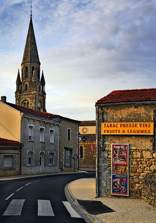
The romantic city of Paris, with its famous art galleries, museums, and cafes, is situated on the Seine River. Bordeaux, with its elegant chateaus, is home to southwestern France's major wine region. Marseille, France's oldest city, is located along the Riviera in southeastern France.
France Travel Information
French cuisine and the latest fashions draw many tourists to France, where visitors can visit numerous wineries and French cafes or shop along the Champs Elysee. The country's food processing industry is very well-known, especially for its soft Brie and Camembert cheeses. Tourists also visit the regions of Alsace, Bordeaux, Burgundy, Champagne, and the Loire Valley, where many of the world's best wines are made. Many visitors also enjoy seeing the famous Eiffel Tower, the Arc de Triomphe and Louis XIV's Versailles Palace. France is blessed with beautiful Mediterranean beaches and majestic mountain resorts as well. Mont Blanc, a popular skiing and mountaineering destination, rises on the French-Italian border to 15,771 feet (4,807 meters), and is France's highest point.
French Tourism
- French Government Tourist Office - Complete guide for traveling in France, discovering French gastronomy, and finding French tourism information.
France Resources
- CIA - The World Factbook - France - U.S. government almanac of France provides maps, geography and statistics.
- Wikipedia - France - This free online encyclopedia includes information about French regions, history and geography.
- France News - News headlines and news article links about current events in the nation of France.
Related European Map Websites
These maps of Europe provide geographical context, showing where France is located in Europe. Three populous neighboring countries, Germany, Italy, and the UK, are shown on the Germany map, Italy map, and UK map websites, respectively.All rights reserved. About us.
Certain maps hereon are © Map Resources.