
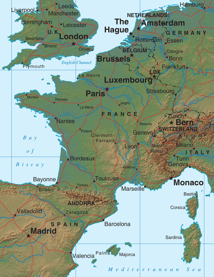
France Relief Map
Map of France > France Locator Map • France Travel Tips • France Relief Map
 To print this map, click on the map. After map loads, press Ctrl+P.
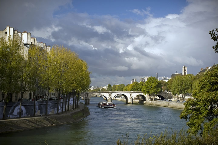 Many of France's most popular destinations fall along rivers. The Seine
bisects Paris, where it easily qualifies as one of the most-painted rivers
in the world! Famous chateaus line the Loire River, which at just over
620 miles (1,000 kilometers) is the longest river in France. The banks of
the Rhone are dotted with vineyards and Roman ruins as the river winds its
way through southern France.
Many of France's most popular destinations fall along rivers. The Seine
bisects Paris, where it easily qualifies as one of the most-painted rivers
in the world! Famous chateaus line the Loire River, which at just over
620 miles (1,000 kilometers) is the longest river in France. The banks of
the Rhone are dotted with vineyards and Roman ruins as the river winds its
way through southern France.
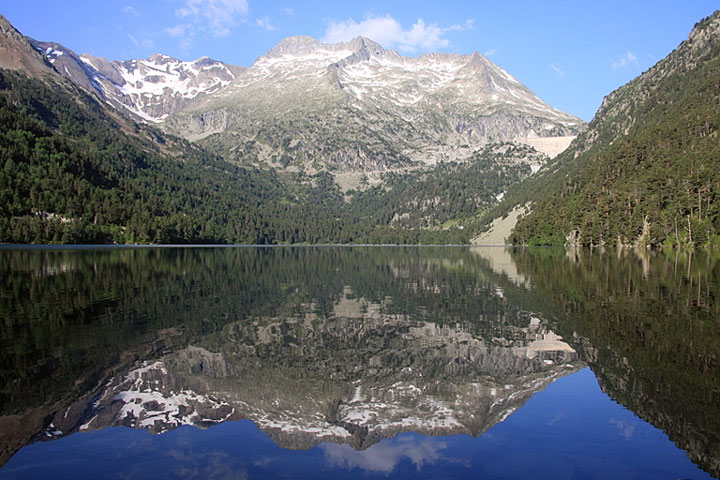 Plains dominate the northwest half of the country, with gently rolling
hills in the north and west. The Pyrenees mountain range divides France
from Andorra and Spain to the south, while the snow-capped Alps rise in
the east toward Italy and Switzerland. The Alps are home to Mont Blanc,
which at just under 16,000 feet is the highest mountain in France.
Plains dominate the northwest half of the country, with gently rolling
hills in the north and west. The Pyrenees mountain range divides France
from Andorra and Spain to the south, while the snow-capped Alps rise in
the east toward Italy and Switzerland. The Alps are home to Mont Blanc,
which at just under 16,000 feet is the highest mountain in France.
In the south, sandy beaches line the warm Mediterranean. The Atlantic Ocean and Bay of Biscay border the west and the English Channel, the north. While France itself measures approximately 600 miles across in any direction, the coastline is more than 2,000 miles long.
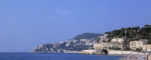 French Riviera - Nice, France